Wednesday, January 29, 2014

The Development of the Surrey Commercial Dock System 1699-1909

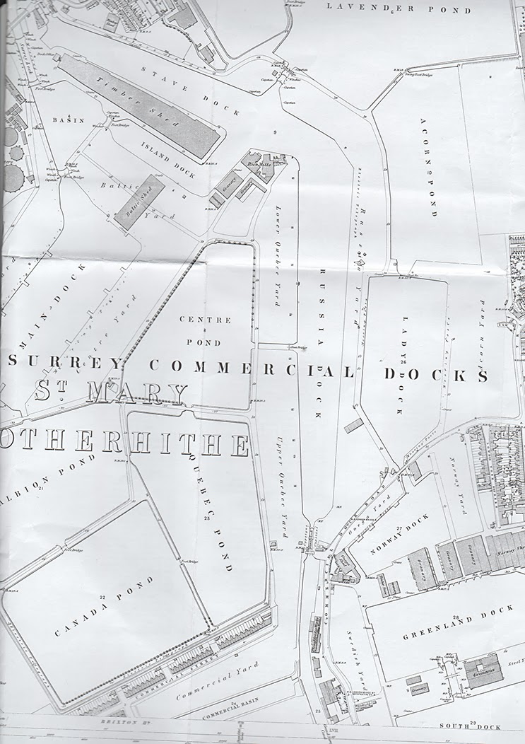
1868 map of Rotherhithe Docks.
Click to enlarge.
After posting about the history of South Dock a couple of days ago, and having posted several pieces about Greenland Dock, I thought I had better write something (admittedly after the fact!) about how these, and Rotherhithe's other docks, ponds and the Grand Surrey Canal all evolved and related to each other.  This is inevitably a simplification, because it focuses exclusively on the docks and the companies that built them, rather than on the wharves, warehouses, what was traded and stored and activities were associated with them.

Although this is a strictly prosaic account of how the docks evolved, they were not merely centres of commerial activity.  Whole lives were lived out at the docks, and visitors were impressed with the bustle, the wide open spaces and even the wildlife.  A.G. Linney's 1929 book Peepshow of the Port of London has a lovely description:  "It may seem strange, nigh incredible, to associate sentiment with Rotherhithe and that enormous tongue of land washed by the waters of the Pool and Limehouse Reach which contains the linked docks and timber ponds and timber yards covered by the embracing name, Surrey Commercial Docks.  yet the region has a spaciousness and an atmosphere such as no other London  dock are can equal.  West India and East India Docks have a historical association quite their own, but neither has the amplitude of 'Surrey.' "

It is probably easiest to follow the story using the 1868 and 1914 Ordnance Survey maps of Rotherhithe, one of which is shown at each end of the post, and you may want to open them (by right clicking) in a new tab or window so that you can refer back to them very easily.  If you are using Firefox, bringing the map open in a new tab will give you a much bigger image than simply left-clicking it, and will also allow you to magnify the sections in which you are interested.  Other browsers may offer the same sort of functionality.

The story of the Rotherhithe docks is mainly a story of maps because it is principally by looking at old maps of the area that the development of the docks can be seen, followed and understood.  It is also a story of research into the records of the companies that owned and created the docks.  Much of the research captured in this post has been assembled from Stuart Rankin's A Short History of The Surrey Commercial Docks (1999), which I have supplemented by other sources together with the use of a lot of online and offline maps!

There is a list at the end of this post of earlier posts that have looked into some of the docks in much greater detail.  Other docks and ponds will be covered in more detail in future posts.

The docks were not built to a single plan, which accounts for the maze-like arrangement of docks and internal locks and channels.  Five different companies were responsible for the way in which the Surrey Commercial Docks appeared before they were brought under the wing of the Port of London Authority in 1909.  Where they are mentioned for the first time, companies are highlighted in lilac, and docks and ponds are highlighted in black.  All images can be clicked to see a bigger version.

Howland Great Wet Dock
For over a century there was only one enclosed dock in Rotherhithe - the Howland Great Wet Dock, which was established in 1699, and in 1763 was renamed Greenland Dock. The Howland Great Dock was established in 1699 on land owned by the Earl (later Duke) of the Bedford on the occasion of the marriage of his grandson and heir Wrothesley Russell, with Elizabeth Howland who was the daughter of another wealthy and influential family.  Its purpose was to provide protection and repair facilities for ships that would normally have moored in the main channel of the Thames. In 1724 it was leased to the South Sea Company, and became a whaling dock.  In 1763 it was purchased by the Wells family, successful ship builders who had a yard up-river in Rotherhithe.  When the Wells family moved their interests to Blackwall the dock was put up for sale and in 1806 it was purchased by William Ritchie who sold it to the newly formed Commercial Dock Company in 1807.  The dock was closed for a year, during which it was refitted as a cargo handling dock specializing in timber.  Later on it handles large quantities of grain as well.

Rotherhithe in 1806, before
development began in 1807.
Click to enlarge.
The Grand Surrey Canal Company was incorporated in 1801 and a circular basin, with an artificial island at its centre, was opened in 1807, its role specifically to act as a cargo transit area for the Grand Surrey Canal.  It consisted of two wide channels with an island in the middle, which fed into the main channel of the canal, and opened out onto the Thames via a lock jut downriver from today's Old Salt Quay public house, on the west of Rotherhithe. When complete, the canal passed across Rotherhithe and beneath Greenland Dock towards Deptford before turning south towards Camberwell (which opened in 1811) and Peckham.  

1807 was an important year in the following evolution of Rotherhithe, and at the same time as the incorporation of the Commercial Dock Company and the opening of the Surrey Basin, the East Country Dock Company was incorporated.  In 1811 its East Country Dock opened, parallel to and immediately to the east of Greenland Dock, with its own lock out onto the Thames.

Norway Dock looking over the bridge at
Acorn Pond, both handling timber. (1870)
Jumping on the bandwagon, a consortium of Rotherhithe landowners created the Baltic Dock Company in 1809.   The land they were planning to develop was immediately adjacent to that owned by the Commercial Dock Company.  It was almost immediately bought out by the Commercial Dock Company.  In 1811 the Commercial Dock Company opened Norway Dock, a small dock that opened off the north (upriver) side of Greenland Dock, followed by a shallow timber pond to its north in the same year (Timber Pond No.3, later named Lady Dock) and another timber pond even further north in 1812 (Timber Pond No. 4, later known as Acorn Pond).  At the time all the Commercial Dock Company docks were known collectively as the Commercial Docks.

As the Commercial Dock Company developed a line of enclosed spaces along the eastern edge of Rotherhithe, the Grand Surrey Canal Company realized that the Rotherhithe section of its canal could be usefully developed to compensate for the financial failure of the canal enterprise, which never lived up to the promises of its original promoters. In 1811 they received parliamentary permission to expand the the channel of the canal that led from the island  Grand Surrey Outer Dock, which was expanded to either side, with the widened area becoming a dock in its own right, with the canal flowing down the middle.  It was named the Grand Surrey Inner Dock.  On the 1868, 1894 and 1914 Ordnance Survey maps, after they had all been further extended, they were shown as Stave Dock, (the northernmost of the island basins) Island Dock (the southern part of the basin gyratory) and Russia Dock (the expanded section of the canal) respectively. 
1820 map showing the East Country Dock,
bottom right, with Greenland Dock to its
north, feeding into Norway Dock and the
timber ponds beyond.  Parallel to it is the
Grand Surrey Canal Company's canal-
based network in its early stages,
This resulted in two companies operating and continuing to develop separate but parallel systems  side by side, one with a lock entrance on the western side of Rotherhithe, the other with a lock entrance via Greenland Dock on the eastern side of the peninsula. There were no links between the two systems, both of which were long and thin, like paper chains, both terminating as cul de sacs without a link to the Thames on the other side of the peninsula, a massively inefficient state of affairs that continued to be maintained through various improvements and developments within each of the discrete systems.

The East Country Dock was bought by the Commercial Dock Company in 1850, which connected it into the Greenland Dock system via a cut between the East Country and Greenland Dock.  The East Country Dock was considerably extended and became a much more useful asset.  The rebuild was completed in 1855. It was renamed South Dock.

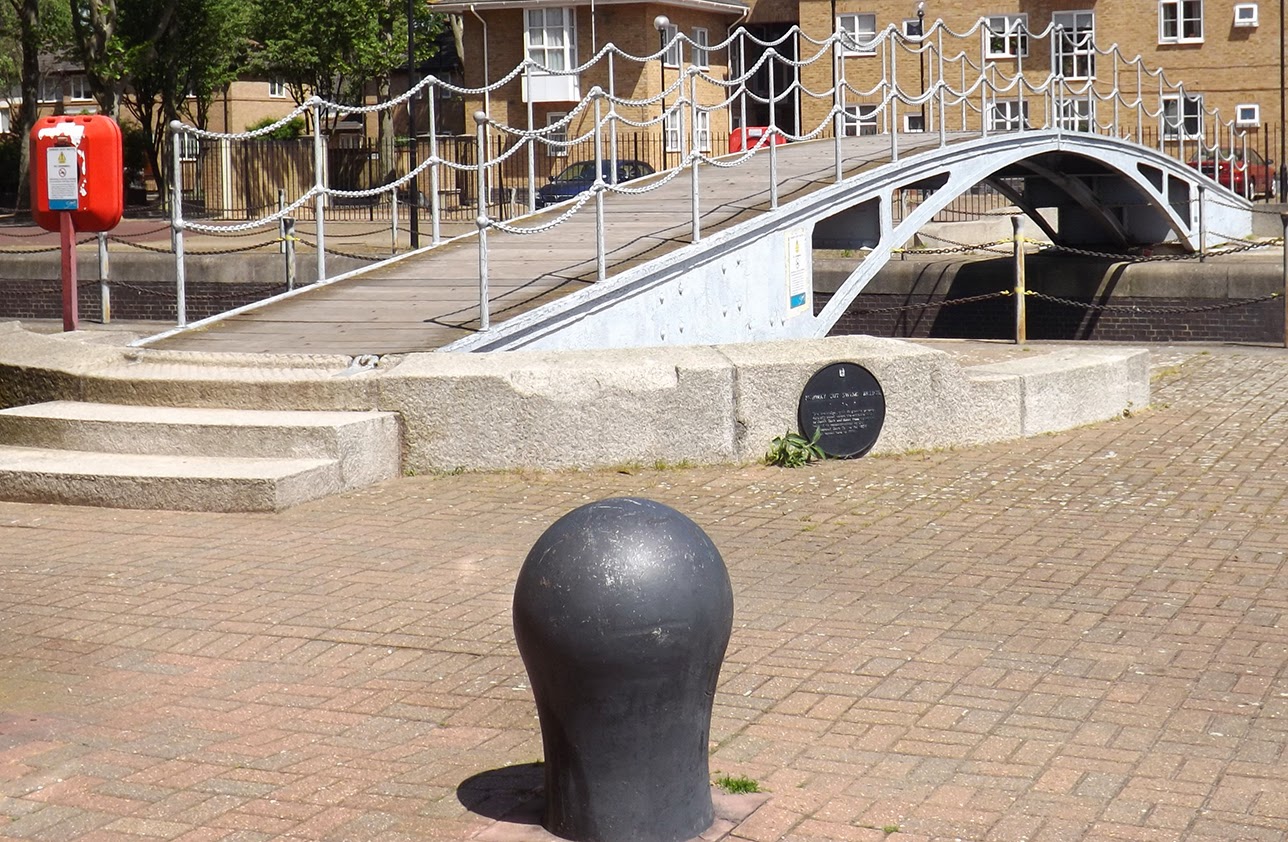
In 1855 the Grand Surrey Canal Company changed its name to more accurately reflect its remit and became the Grand Surrey Docks and Canal Company and set about modernizing in order to accommodate the larger and deeper vessels that were being built.  One of the biggest Rotherhithe landowners was Lord of the Rotherhithe Manor, Sir William Maynard Gomm and he both sold land to the dock developers and gave land to the Church to extend their activities in matters both religious and educational.  He sold land to the Grand Surrey Docks and Canal Company that enabled them to seriously extend their operations.  An extended lock was built upriver and the old one was eventually filled in, certainly by 1888.  The new lock, the Surrey Lock, opened into a new basin, the Surrey Basin (renamed Surrey Water by developers of the 1980s).  The basin was filled in when the docks were closed but re-excavated by the London Docklands Development Corporation and is now one of Rotherhithe's attractive water features.

Map showing the brand  new
Surrey Basin
The new basin was connected not only to the new dock but at its east to the newly modernized Outer Dock, later renamed Island Dock, which in turn fed into Outer Dock (Stave Dock) and into the newly expanded Inner Dock (Russia Dock); and to its south the new Main Dock (later Albion Dock, and now preserved as the shallow ornamental canal Albion Channel, which connects Surrey Water to Canada Water).  All these improvements were completed by 1860.

By now the two companies and the two systems were each small empires on Rotherhithe.  Between the bodies of water were wharves, warehouses and cargo handling equipment. Along the foreshore were ship building and repair businesses, whilst every available nook and cranny between the foreshore and the docks was taken up with housing, small industries and businesses, and a growing number of public facilities like churches and schools.

Commercial Dock Company
Logo
By 1862 both companies had made further improvements to their systems.  The Surrey Commercial Dock Company had invested in a further two ponds (numbers 5 and 6, later Lavender Pond and Globe Pond respectively).  The Grand Surrey Canal Dock and Canal Company had added four timber ponds to their system for the first time:  Timber Ponds 1, 2, 3 and 4 (later named Albion Pond, Centre Pond, Quebec Pond and Canada Pond respectively), all of which can be seen on either the 1868 map at the top of the post or the 1914 map at the end.   The first of these, Timber Pond 1 (Albion Pond), extended directly out of Main Dock, which fed in turn into Canada Pond to its south and Quebec Pond to its east.  Canada Pond also linked into Quebec Pond.  Quebec Pond connected to Centre Pond to the north, which ran parallel to Main Dock, but was separated from it by a large area of quays and yards.  This arrangement is seen most easily on the 1868 map above, which also shows how the system was parallel to but separated from the Surrey Commercial Dock Company's Russia Dock.

Surrey Dock at Surrey Basin at the time of
the addition of hydraulic lock gates in the 1870s
In 1864 the two companies that had carved Rotherhithe up between them were amalgamated into a single company, the Surrey Commercial Dock Company, thanks to a price war between the two that damaged both companies and competition from dock companies north of the river. It as at this time that the docks were all renamed with rather more memorable names that also removed the duplication of titles like "Timber Yard 1."  Linkages between the two systems were made, the first between Lavender Pond and Stave Dock.

At some time between 1862 and 1868 the long thin Commercial Dock was established, a little way beyond the end of Greenland Dock, and was connected to Russia Dock.  I have been unable to find out exactly when when it was established, or why, but a map of 1862 shows nothing where the dock was located, but it is clearly marked on the Ordnance Survey map of 1868.

Canada Dock under construction 1875-6
A major new investment was Canada Dock in 1876, established specifically to handle the larger iron vessels and their cargo.  Engineer James McConnochie had to resolve problems caused by the proximity of the East London Railway.  The dock quickly became nearly as important as Greenland Dock. The Surrey Quays shopping centre car park takes up much of the land that this occupied, with a small section of the dock left behind as a much appreciated water feature.

If you compare the 1868 map at the beginning of the post and the 1914 one at the end, you can see how the ponds were re-arranged to enable the construction of Canada Dock.  The following will be much easier to follow if you can look at the relevant pieces of both the 1868 and 1914 maps.  Canada Dock replaced the western thirds of Albion and Canada Ponds.  The middle third became a wide set of yards.  Final third, to the east, became a single pond, amalgamating what remained of Canada and Albion Ponds to become Canada Pond.  The new Canada Dock and Canada Pond were connected to each other and to Quebec Pond, which remained in its original location without changes to its size or shape. This, in turn, was still connected to Centre Pond to its north.  Canada Dock covered part of them and the rest of the area formerly occupied by the ponds was converted to use as yards

Surrey Commercial Dock Company personnel on
the Company's steam tug Canada, shortly before
it was incorporated into the PLA.
Greenland Dock was expanded in the late 1890s, after an Act of Parliament had been obtained in 1894, doubling on length, and incorporating Commercial Dock.  It forced Commercial Dock Road, which used to pass along its end, to be rerouted, cut short the railway link to Norway Dock and had to incorporate the Grand Surrey Canal, which now passed across its centre.  It also involved the demolition of a considerable amount of property.  As an engineering project it presented considerable challenges and the extension eventually cost the company £940,000.

In 1908, concerned by price wars that undermined all of the dock companies, the government stepped in and, under the auspices of the new Port of London Authority, amalgamated all of the companies into one publicly owned and centrally managed entity.  This became operational in 1909.  Before the Surrey Commercial Dock Company was taken over, a farewell dinner was held and a photographic record of the company's holdings and personnel was made.

Between 1909 and 1969 the docks continued to operate, changing with the times until changes in the industry exceeded their ability to survive in an increasingly technological world.  The 50 year period between 1909 and 1969 will be covered on another post.  

PLA Logo
The legacy of the Surrey Commercial docks, much of which the London Docklands Development Corporation went to considerable trouble to preserve, is all around us in Rotherhithe.  Greenland Dock, South Dock and Surrey Basin all preserve the areas of the original dock, and are filled with water.  Surrey Basin and Greenland Dock are peaceful and open, whilst South Dock is now a busy marina.  Albion Channel preserves the line of Albion Dock and connects Surrey Basin with the truncated remains of Canada Dock.  Russia Dock Woodland preserves the old eastern quayside of the Russia Dock and contains a tiny remnant of Globe Pond.  Bridges, capstans, lock gates, bollards and many other dockside features survive too.  Our rich dockland heritage is all around us in Rotherhithe.

Some of the individual docks mentioned in this post have been covered in earlier posts in more detail, and many more will follow.  Here are those that have been published to date:

Rotherhithe in 1914

Monday, January 27, 2014

A short history of South Dock, Rotherhithe, 1811 - 2014


East Country Dock, bottom right in
1828.  Immediately to its north is
Greenland Dock. Click to
enlarge the image.
Only two of the docks that were built in the 19th Century are preserved in their entirety today:  Greenland Dock and South Dock (sometimes known as Sweden Dock), both at the east side of Rotherhithe peninsula and connected to each other by a small channel.  South Dock, today London's biggest marina, is the only one of the two docks to maintain its operational connection to the Thames.  To see how South Dock fits into the history of Rotherhithe's docks, see the post The Development of the Surrey Commercial Dock System 1699-1909.

I have had to keep some of the photographs in this post small to fit them all in to the text, but if you click on them they will expand to full size so that you can see them in greater detail. 

The granite bollards of the
East Country Dock are unique
on Rotherhithe
South Dock began life as the East Country Dock in 1811 by the East Country Dock Company. Ralph Dodd was the engineer originally hired to build it in 1801, on a considerable wage of £600 a year. He was a rather mixed blessing, full of ideas but not always the best person to execute them.  In 1802 he fell out of favour with the Eastern Dock Company and he was given a gratuity and dismissed as engineer, apparently because he was simultaneously engaged on other work and his fees were too high. Whatever the reason for his dismissal, he was quickly replaced.

The dock first appears on maps in the early 19th Century as East Country Dock, clearly shown on maps in Smiths Map of 1828, Cary's map of 1837, and Davies's 1843 map as a long thin, dock, as long as Greenland Dock was at that time, but around a quarter of its width.  It is difficult to imagine why such a long, thin dock was considered to be advantageous.  The East Country Dock Company, which was formed in 1807 and was named for its trading connections with the eastern Baltic.  

The East Country Dock was not connected to Greenland Dock, which was owned by a rival company, and it therefore required its own lock out onto the Thames. The dock was built specifically for the Baltic timber trade.  It is thought that the distinctive granite bollards that dot the edges of the dock probably date to this time.  

Weller map, 1868
Although attempts were made to take over the dock, the East Country Dock Company retained its ownership of the dock until 1850 when the dock was purchased for £40,000 by the Commercial Dock Company, which was already developing vast areas of Rotherhithe for mercantile use. 

Over the next two years, between 1850 and 1852, the Commercial Dock Company expanded the dock, doubling its width at a cost of £190,000, extending its area to 5061 acres and its depth to 27ft. It became known as South Dock and it was connected to Greenland Dock and the rest of the Commercial Dock network to the north. It was designed and overseen by important engineer James Walker, who was also responsible for major extension work at Greenland Dock.  There is a bust of him on a tall plinth overlooking Greenland Dock outside the Moby Dick pub.  The lock has walls of sandstone ashlar.  It now measured 48ft wide and, somewhat oddly, was only 25ft deep, meaning that it was 2 feet shallower than the dock itself.  A newly designed self-acting sluice was installed in 1855 is preserved.

A painting from 1888 showing
a view from the same standpoint
(Museum of London Docklands)
A connection to the rail network was established in 1855, which linked South Dock, Greenland Dock and Norway Dock.

In the same year James Walker's swing bridge was erected across the lock.  It was moved in 1987 to Greenland Dock, where it crosses Norway cut. In 1862 Henry Grissell's swing bridge was installed across the entrance lock.  Although it is no longer there, this bridge can also still be seen as it was moved in 1860 by the Port of London Authority to cross Steelyard Cut, the connecting channel that runs between South Dock and Greenland Dock.

A photograph taken in the late 1870s shows Steelyard Cut with some low buildings stationed along the quay, and sailing ships and lighters dotted around the docks, with a tug in the foreground. An 1888 painting of the dock by Tatton Mather, on display at the Museum of Docklands, shows a remarkably similar similar scene from a very similar vantage point, but with some much taller and very elegant brick warehouses situated behind the lower buildings shown in the 1870s photograph.

A photograph from  the late 1920s, showing an aerial view of a busy Greenland Dock and South Dock, shows the same buildings to the north of Steelyard Cut. The bridge in the painting looks very like the one in the 1870s photograph.

South Dock, bottom right,shown by sculptor Michael
Rizzello as it was in 1896. Stave Hill.
Today, the cut survives and is flanked by Henry Grissell's 1862 swing bridge, which was moved there at a later date from its original position across the entrance lock to South Dock.  The buildings were lost during the Second World War and have now been replaced by modern housing. 

In 1865 the two dock operating companies, The Commercial Docks Company and the Grand Surrey Docks and Canal Company, amalgamated to form one big company, the Surrey Commercial Docks Company.  

South Dock warehouse in the
late 1870s, with the lock
entrance and hydralic capstan
in the foreground
By the late 1890s both South Dock and Greenland Dock (which, at that time, was much shorter than it is today) had locks onto the river and were connected to each other and, via Greenland Dock, to a whole network of timber ponds, basins and the Grand Surrey Canal.  To the south of them a road ran from east to west, continuing up the eastern side of South Dock and crossing the Grand Surrey Canal to the south.  The Grand Surrey Canal passed uninterrupted to the south of both, linking Surrey Basin in the west of Rotherhithe with the rest of the canal which headed first east and then south towards Peckham.  Rotherhithe was a vast mosaic of docks, basins and timber ponds flanked by endless warehouses.  Housing, small shops and pubs were all confined to the edges of the river, where they rubbed shoulders with ship repair and related services.  It is all beautifully captured in Michael Rizzello's 1896 sculpture of Rotherhithe, which sits on the top of Stave Hill.

As the docks became busy and settlements grew up around them, requirements for improved public services became obvious, and local churches and schools were established.  Trinity Church, in the nearby Downtown area, was established in 1838 with a small school, and St Barnabas on Plough Way was built in 1872, with its associated school opening in 1874.  In the late 1890s Greenland Dock was extended, meaning that the Grand Surrey Canal now crossed the middle of it, but still passed beneath the end of South Dock.  The tiny building on the corner of Rope Street and Sweden Gate, known as the Yard Office was the old toll building for the canal, and was built in 1902 after the extension of Greenland Dock.  The extension of Greenland Dock also required the diversion of the road that used to run parallel to the canal and the early termination of the railway at South Dock, whereas it formerly ran to Norway Dock.

The Dog and Duck public house, Rotherhithe
The airship and aircraft bombings of the First World War did not damage the dock, but it fell victim to the more intense and targeted Luftwaffe bombing of the Second World War.  The lock was badly damaged and was sealed until after the war.  In 1944 the connection with Steelyard Cut was sealed off, the dock was drained, the floor was spread with rubble and the dock was used for the construction of concrete sections for Mulberry Harbour units. Mulberry Harbours were modular units which, when assembled, were used to create temporary harbours.  They were used for the Normandy beach landings. When they were complete, Steelyard Cut was re-opened, the dock was refilled via Greenland Dock, and the sections were floated out onto the Thames through Greenland Dock's entrance lock.  Warehouses were also hit, and one of the more notable casualties of the bombings was the Dog and Duck public house, which sat at the end of South Dock and had been there in some form since at least 1723.  All that remains of it is the name of the Dog and Duck staircase, one of a whole series of watermen's stairs that are found all along Rotherhithe's foreshore. 

After the war, South Dock's entrance lock was repaired and warehouses were replaced.  Although the docks had a brief period of revival following the war, traffic fell off for a number of reasons, mainly due to containerization of cargo and the specialized handling equipment, large docks and entrance locks required. The Surrey Commercial Docks closed in 1969, the end of an era.  Most of the docks, including South Dock, were filled in, although South Dock and others were re-excavated later as part of the regeneration plans, to bring the local heritage to life once again, and to add attractive water features to the area for the benefit of residents.

At some point, possibly during the late 1950s or early 1960s a set of very ugly warehouses were built on the eastern side of South Dock. These warehouses were still in place when the London Docklands Development Corporation began to redevelop South Dock. The London Docklands Development Corporation (LDDC), which operated between 1981 and 1994, had already achieved success in its Canary Wharf developments on the Isle of Dogs, in spite of considerable opposition from local residents.  Their work at Rotherhithe followed that success.  One of the LDDC's first projects at South Dock was to commission the lock control building, which overlooks the hydraulically operated lock at South Dock.  Built by Conran Roche between 1986-9 it looks remarkably like a very short air traffic control tower with a bowed control room and reflective glass, on a cantilevered pedestal.

Before and after - the
Plough Way warehouses
and the modern homes that
replaced them
Although the LDDC had few financial resources of its own it did own land and was therefore in a position to work closely with developers to regenerated the derelict docks.  A lot of surrounding buildings were still standing, although abandoned and completely derelict, and these were knocked down by the LDDC.  The vision for Rotherhithe was rather different from its plans for Canary Wharf, and focused primarily on the development of the area for residential purposes.

One of the earliest residential developments was Baltic Quay at the end of South Dock.  People purchasing apartments in the landmark building must have been taking a huge gamble on the potential success of the Rotherhithe venture, with the derelict 60s warehouses  still standing, great gaping eyesores amidst the optimism of the LDDC's plans for regeneration.  Falling on the Deptford side of the Southwark-Deptford border, which ran along the eastern side of South Dock's quay, the fell outside of the London Docklands Development Corporation's dockland regeneration remit, and were therefore not knocked down until the mid 1990s.  Although the docks themselves were closed to shipping in 1969, many of the warehouses continued in use, and the South Dock warehouses in the photograph were employed as bonded warehouses.  Containers of goods were delivered and stored there prior to distribution.  The photograph above shows the warehouses as they were shortly before they were abandoned, but they were much worse in the early 90s when I first saw them with wide hollow entrances to the starkly desolate and rather alarming wind-tunnel interiors, their floors covered in debris and shattered glass, broken windows rattling in the wind.

Baltic Quay
The massive Baltic Quay complex was built by Lister Drew Haines Barrow, opening in 1990. Visible from miles around and always recognizable due to its vast arched roofs, it is probably the most distinctive and imaginative of all the tall buildings on Rotherhithe. When it was built it was envisaged as a combination of office space with apartments above, but the demand for residential space far exceeded that of commercial offices and, apart from the ground floor, the office space was converted for residential use by Barlow Henley Architects.   Eventually the office space on the ground floor was also converted to apartments.  Baltic Quay will be covered on another post.  It reaches fourteen storeys. Its external metalwork was first painted  in a lively combination of blue and yellow, making it bright and welcoming, but more recent counsel clearly decided that this was a bad idea and it is now uniformly pale grey. The photograph here shows it after it was given its London-grey colouring.

Swedish Quays
On the West side, with views over either Greenland Dock or South Dock, a smaller complex was built between 1985  and 1990 by David Price and Gordon Cullen, named Swedish Quays.  Although rather more conservative than Baltic Quay, mainly due to its smaller scale, its brick construction and deep brown colouring, it still stands out as something somewhat different from the normal bricks-and-mortar style the dominates dockland and canal-side developments throughout the country thanks to cream rendering, tall columns, interestingly arranged glass panels, arched windows at the top of the buildings and something of an echo, however elusive, of Charles Rennie Mackintosh and other turn of the 20th Century designers. 

Modern apartments
overlooking the entrance
lock at South Dock
on Rope Street
When the warehouses on the east side of the dock were pulled down, they were replaced with the three-storey residential complex that remains today, overlooking South Dock on the one side and Plough Way on the other. (shown on the above before-and-after photograph) Rainbow Quay was added next to Swedish Quays.  Later, three-floor apartments were built over their garages behind the dock office at the Thames end of Rope Street. Their appearance, with facades consisting of  wood-lined curved bays on the two lower floors and top recessed floors above, are unusual and not to everyone's taste, but they do contribute diversity to the often bland local architecture.  

Today South Dock is London's largest private marina, providing both temporary and residential moorings on around 200 berths. It is operated by Southwark Council.  If you are keen on boats, old and new, big and small, this is a great place to take a stroll.  It is home to everything from narrow-boats, converted Humber keels and Dutch barges to wind-powered vessels of all sizes, alongside all sorts of strange and bewildering works-in progress.  Some of these boats are stunning, some are frankly hideous (particularly where lovely old hulls have been sabotaged with appalling conversions for habitation), but all are fascinating.  Some have been moored there longer than I have lived here and feel like old friends.  The Steelyard Cut still connects South and Greenland Docks, and the marina extends into the top end of Greenland Dock.  A modern lift bridge enables Rope Street to pass over the cut whilst allowing vessels to pass between the two docks.  Entrance to the marina is still via South Dock, the Greenland Dock having been blocked off after the closure of the docks in 1969.  The new hydraulic lock gates were added in the mid 1980s.

Rainbow Quay
Between them Greenland Dock and South Dock offer a peaceful atmosphere with a wide variety of modern architectural styles flanking their former quays.  At the same time, there are many features of the docks that survive and they provide a glimpse of a very different dockland past.

Once associated with a busy and often chaotic commercial activities, the docks now form the heart of a residential area that is characterized by its much-appreciated tranquility.  But the traces of its vibrant history, even after the Luftwaffe attacks and massive regeneration work, can still be observed by those who have an interest and take the time to look.


Steelyard Cut.  The modern Rope Street lift bridge and the 1862 swing bridge by Henry Grissell


Now crossing the Norway Dock entrance from
Greenland Dock, this bridge originally crossed
South Dock, where it was established
in 1855.  It was moved by the LDDC in 1987.


The old warehouses on South Dock
before demolition, with Aragon Tower in the
background before the redevelopment
of the Pepys Estate


Sunday, January 26, 2014

HMS Tartar, built in Rotherhithe by John Randall in 1756

A view of Cuckold's Point by Samuel Scott, c. 1750-60
Built in Rotherhithe in 1756 by John Randall at Nelson Dock (Cuckold's Point), HMS Tartar was the second Royal Navy ship to bear the name.  She was a sixth-rate 28-gun frigate.  She was based, with alternations, on the design for the 1748 HMS Lyme by former shipwright, the naval architect and Surveyor of the Navy Sir Thomas Slade.    

Hundreds of ships were built for the Navy in Rotherhithe.  Whilst the Royal dockyards built the expensive first- and second-rate ships of the line, lower specification ships were often sub-contracted to private yards.  The hull and its interior fittings were the job of the sub-contractor and ships were usually taken elsewhere to be fitted with masts and rigging and, at another location, with armaments.  

John Randall was one of the biggest names in Rotherhithe ship-building.  Tartar was ordered when he had only just established himself at Nelson Dock but he also leased shipyards at Greenland Dock.  He later went into business as Randall, Grey and Brent and later Randall and Brent,  but at this time he is listed simply as John Randall Esq.  HMS Tartar was one of his smaller commissions - in 1761 he was contracted to build the Suffolk, a 74-gun ship of the sort that were to become the Navy's core.  Unfortunately almost nothing is known about John Randall or his son, also John.  The shipyard, the more recent remains of which are still visible in the carparks of the Hilton Hotel, is also quite poorly recorded at this time.  A map of 1746 shows one wet dock on the site, and by 1813 a second had been added alongside, but it is not known what the site looked like in 1756, when Tartar was launched.

The frigate HMS Tartar was build along the same lines of the earlier Lyme with alternations to improve stowage of men and the carriage of guns.  Tartar was originally planned as at 24-gun ship but four guns were added. Just over 587 tons (he average tonnage of a 28-gun frigate was 600 tons), she was 117ft 10in long and 33ft 9in wide.  On her upper deck she carried twenty four 9-pounder guns and on her quarter deck four 3-pounders.  She also carried 12 swivel guns.   She could carry up to 180 men.  Originally commissioned to serve in the Channel and the Bay of Biscay, she went on to serve for 41 years in various parts of the globe.

HMS Tartar in Barbados in 1764
From the ShipStamps website
Frigates had been in use in the Royal Navy since the mid 1600s.  The term was applied to a variety of designs but the role of the frigate was always the same - to move at speed, with sufficient firepower to defend herself and cause problems for others, but not as well armed as much slower but larger warships.  They were classed as fifth or sixth rate ships, depending on the number of guns they carried.  Frigates were used as scouts for the main fleet, and in battle they would assist disabled ships and take command of captured ships.  She could also take on ships of comparative size and firepower.  Independently, they were sent to foreign seas to capture pirates and foreign privateers in order to protect British commerce.  The 28-gun ships were phased out during the early 19th century - in 1794 there were 22 of them but by 1814 there were none remaining in service. 

The ship's first commander was Captain Lockhart, who used her to take out a number of privateers.  In 1756, still under Lockhart, she served in the Seven Year's War under a number of different captains. The Seven Years War lasted from 1756 to 1763 and has passed into history as one of Britain's naval triumphs.  Although its geographical reach was considerable, from America to India, it was mainly about power struggles and mercantile conflict amongst Europe's dominant countries. It was considered to be a massive success for Britain, which gained numerous territories in the Treaty Of Paris.  Tartar was paid off after 1763, undergoing survey and a refit, during which the ship's bottom was re-coppered, after which she sailed to Jamaica in 1764 to Barbados under Captain Sir John Lindsay.

The trip to Barbados was a scientific experiment that was of considerable importance to the Navy.  On board was William Harrison together with the H4 marine chronometer designed by his father, John Harrison.  Parliament had set up the Board of Longitude to offer a prize to anyone able to find a solution to the task of determining longitude at sea.  The first trans-atlantic voyage had been a success but the Board wanted further trials, so the trip to Barbados was undertaken.  It was hoped that the chronometer carried by Harrison would be sufficiently accurate to determine longitude.  Tartar arrived in May 1764 and Harrison returned back in England in July of the same year.  On arrival back in England the chronometer was found to be only 15 seconds slow and had been successfully used to determine longitude with great accuracy.  However, the Board dragged their heels in making payment and the full prize was never awarded to John and William Harrision.   

Tartar was paid off, refitted and recommissioned many times.  She was sent to the Falklands dispute in 1770 and took part in attacks on American during the American Revolutionary War.  In Portugal in 1779 her captain captured the Spanish 28-gun Santa Margarita.  In 1781 she was at the Battle of Dogger Bank and in 1782 she sailed for Jamaica and America.  By 1793 she was in the Mediterranean but in 1796 was back in Jamaica.  She took many privateers during her career.      

HMS Tartar was eventually wrecked off San Domingo in 1797, by then 41 years old.


Friday, January 24, 2014

"Orient," built by Bilbe and Perry at Nelson Dock, 1853-1879

Orient by Thomas Goldsworth Dutton, 1853.
National Maritime Museum.
In her day, the clipper Orient was a well known name, partly due to her speed and her role in the Crimean war, but most significantly because she was the first ship to serve in the passenger carrying Orient Line, a company that was eventually absorbed into the PandO empire. 

Built by Thomas Bilbe in 1853 at Nelson's Dock (or Cuckold's Point) she was constructed for Anderson and Thomson by Thomas Bilbe, for use in the Australian gold boom.  Gold had been found in Australia in 1851, and by 1852 the fortunes being made in mere weeks attracted unskilled workers from the British Isles, all hoping to make their own fortunes.  As speed of arrival in Australia was an important factor for these prospectors, the basic clipper design was still appropriate even though the cargo was now human.  In response to the increased number of families emigrating, the government introduced new regulations to improve conditions on board ships carrying emigrating passengers.   

Thomas Bilbe, who specialized in tea clippers, has been mentioned on previous posts about Wynaud and Borealis, and he was a most remarkable man.  As well as tea and wool clippers, he built a ship that was armed and designed to operate in the illegal opium trade, he transported Chinese coolies as cheap labour, and pioneered a new method of hull framing and invented a mechanical slip, which he patented.   The slip can still be seen today immediately next to the Hilton Hotel's car park on Rotherhithe Street, its engine house preserved immediately behind it, facing onto Rotherhithe Street.

It is unclear how Bilbe became involved with the owners of The Orient Line, but he built a number of clippers for them (under the names James Thomson and Co. and Anderson, Anderson and Co.) at the Rotherhithe yard, beginning with Celestial, which he built for James Thompson and Co. in 1851 and ending with Yatala in 1865 and Argonaut in 1866, both of which Bilbe built with his business partner, the former shipmaster William Perry.

Orient in Port Adelaide
Orient had a registered tonnage of 1033 tons, she was 184.4ft long, with a beam of 31.7ft and a depth of 21.1ft.  Her hull was a composite of wood on an iron frame, and she had three masts.  Because she was destined for the Australian gold rush, beneath a 61ft poop she was fitted with cabin space that had not been factored into any of the earlier Bilbe designs.  Orient's first sailing as a passenger carrier was in 1856 from Plymouth to Australia under Captain A. Lawrence.

She had only been operating for a year when she was chartered to take troops to the Crimea, and in the September of 1854, referred to as Transport 78, she safely delivered members of the  she 88th Connaught Rangers.  Remarkably, she survived a gale that wrecked over 30 ships at Balaklava that saw the loss of over a thousand lives.  She continued to be employed the military between 1855 and 1856 when she served as a hospital ship. 

Following her service in the Crimea Orient became the first ship to operate for the Orient Line. The Orient Line began its life as a ship-broking company, established by James Thomson in 1797, which invested in a small fleet of its own that expanded steadily through the first half of the 19th Century, its ships sailing all over the world.  In 1829 James Anderson joined the company in a senior capacity, eventually becoming lead partner.  Anderson's nephew, also James Anderson, joined the firm in 1828.  In 1854 the company was renamed Anderson, Thompson and Co, and in 1869, after the death of the last Thompson to be involved in the company, it became Anderson, Anderson and Co.  The clipper Orient, already equipped to carry passengers, was the first ship to serve the new The Orient Line of Packets (better known simply as The Orient Line), which was established to carry passengers and some cargo, mainly wool, to and from Australia. 

Orient spent 21 years operating between England and Australia, completing a voyage every year until 1877.  Even though the East Indian routes had fallen to the far more efficient steamships that could make use of the Suez Canal since its opening in 1860, the steamers were unable to carry or source sufficient coal for the trip to Australia, so the clippers continued to have an important role carrying Australian wool and passengers.. 

Orient, commemorated on a stamp
In January 1862, en route from Adelaide to Plymouth, she caught fire. In spite of the inspired direction of her Captain and the work of the crew, the fire took hold and spread during the course of that day and the following night.  The decision was taken to offload the female passengers onto a Dutch ship that was standing by, but eventually the fire was extinguished and the ship limped into Ascension in the South Atlantic Ocean for temporary repairs.  She then returned to London, where the ship's insurance underwriters rewarded Captain Lawrence, his officers and crew, with plate worth £900.  

Orient's fastest passage time was in 1866, when she completed the journey between Plymouth and Port Adelaide in 72 days under her second commander Captain Harris under whose captaincy she achieved her fastest times, although her average was around 95 days.  As usual on this route, she normally stopped off at Capetown and St Helena on her return journey. 

One of the famous contemporaries of Orient, on the same route, was the clipper Lammermuir.  In 1873 Lammemuir departed Blackwall without the ship carpenter's tool chest, a vital component if the ship ran into trouble. The Blackwall-based owner of the great ship,  John Willis, anxious to reunite the ship's carpenter with his all-important tools, entrusted the chest to Orient's Captain Mitchell.  His initial instruction was simply to deliver the chest to Lammemuir when both ships arrived in Adelaide. But Captain Mitchell promised that he would overtake Lammermuir before she reached the Equator, so in fine good humour, John Willis wagered Captain Mitchell £5.00 that he would not be able to do so,  which probably seemed like a fairly safe bet as his own ship already had a ten day start.  But Orient was able to make the delivery successfully, making up the two week gap before Lammermuir reached the Equator, and Orient's captain won his wager with John Willis.  Orient actually arrived in Adelaide six days earlier than Lammermuir, effectively putting the icing on Captain Mitchell's cake. 

In 1879 Orient was sold to Cox Brothers of Waterford in Ireland.  She sailed for them from British west coast ports to Canada and the United States. In 1891 she was again sold on. She was de-masted and converted into a coal hulk off Gibraltar, an unusual fate for a former clipper.  She was only broken up in 1925.


Thursday, January 23, 2014

Peter Hills School

At number 70 St Marychurch Street, the former Peter Hills School in Rotherhithe village is one of the few 18th Century buildings left standing in Rotherhithe, and is therefore of particular importance to the area's heritage.  Now converted for use as offices, it was established in 1742 as a charity school, having moved here from nearby.  The school itself was established in 1614.

The school was founded by its benefactors Peter Hills and Robert Bell.  Peter Hills, a seafarer, Master Mariner and Brother of Trinity House.  When he died in 1614, he left a sum of money to enable the establishment and ongoing maintenance of a school.  Robert Bell is a more mysterious figure, although he was a friend of the St Mary's Rector, Thomas Gataker, who was undoubtedly a supporter of the project.  

The school was established initially to supply education for 8 sons of impoverished seamen.  Reverend Beck, writing in 1907, describes it as follows: "The schoolmaster had a house of residence and a small yearly endowment that he might in it teach eight boys, sons of Mariners of Redriff.  The sum left by Peter Hills was small, Six pounds per annum, secured as a Rent-charge upon Messuages belonging to him.  One moiety of this sum was to be paid to the Schoolmaster, the other moiety to the Churchwardens for the Poor."  The arrangement continued for a remarkable 280 years until 1900 when the parish and the school were incorporated into the Metropolitan Borough of Bermondsey, who refused to continue with the arrangement.  The school was located in a building at the east end of the church.  In its first incarnation it was known as the Free School.

In the early 1700s the initial investment in the school was no longer sufficient and additional funds were raised which allowed the school to be hugely expanded, providing education for 65 boys and 50 girls.  An amicable fund set up in 1739 supplied funding to provide for an additional 12 boys.  In 1742 it became known as the Charity School. 

A board survives in St Mary's Rotherhithe that records those who donated money to the school to keep it running when finances ran low, and this way of funding the church was maintained until the early 20th Century.

Following the demolition of the building in 1795 a house was purchased by the vestry from one Richard Vidlar to replace it. This is the building shown on this page, and dates to the early 1700s.  The newly housed school opened in 1797.  The two lovely figures of the schoolchildren that decorate the first floor are made of Portland Stone.  Thankfully, the building is Grade II listed, and been since 1949.  It is described as follows by English Heritage as follows:

The statues were added to the building when the school
was established here in 1797. 
Photograph by Chris Lordan
House, later a school, now an office. c1700. Red brick with stone dressings, parapet with stone coping. 3 storeys and 3 bays. Front with stone quoins and plinth has 6-panel door with decorative fanlight to right, set into timber doorcase with panelled reveals, sunk panelled pilaster jambs supporting entablature with cornice, projecting door-hood long since removed. 1st-floor centre window has stone plaque beneath flanked by scroll corbels supporting figures of boy and girl in period costume of c1700. Ground-floor windows have brick aprons, others brick panels below. Flat, gauged-brick arches to ground- and 1st-floor windows; cambered, gauged-brick arches with keystones to 2nd-floor windows. All are sash windows with glazing bars in flush frames. Blank, brown brick return to right. Rear elevation rebuilt. INTERIOR: retains original panelling and staircase with barleysugar balusters and carved brackets. The plaque indicates that the free school founded in 1613 and instituted in 1742 moved here in 1797.

In 1836 the girls moved out of the building and were educated instead at the new St Mary's School in Lower Road.  An extension of the Peter Hills building in the property's garden enabled up to 150 boys to be educated there by the late 1800s.  By 1901, the Reverend Beck was able to write that "this admirable institution survives to the present day, being incorporated with later foundations of a like character, and it is now a flourishing school of 200 boys doing a most valuable work for the rising generation of our parish."

As other schools became established in the 19th century, many affiliated with local churches, the Peter Hills school became amalgamated into the larger network of education in Rotherhithe.

Apparently the building was used by the fire service in the Second World War.  It became part of St Mary's Rectory in the 1970s and was later converted for use as offices.  The Peter Hills name lives on in local education in the form of the modern Peter Hills with St Mary's and St Paul's C of E Primary School, which can be found at 2 Beatson Walk.  

Peter Hills died on 26th February 1614, a century before the new St Mary's was built in 1714-15.  Fortunately, some of the memorials were taken from the old church and installed in the new one, and the Reverend Beck, writing in 1907, tells how the three portions of a monumental brass dedicated to Peter Hills and embedded into the floor of the old church were taken into the new church and, because they were so badly eroded, were mounted on wood and hung on the wall.  The brass includes a portrait of Peter Hills and both wives and the inscription reads:

Here lies buried the body of Peter Hill, Mariner, one of the eldest Brothers and Assistants of the Company of the Trinity, and his two wives; who while hee lived in this place, gave liberally to the poore, and spent bountifully in his house;  and after many great troubles, being of the age of 80 yeeres and upward departed this life without issue, upon the 26 February, 1614.  

This was made at the charge of Robert Bell.

Though Hills be dead,
Hills' Will and Act survives
His Free-Schoole, and
his Pension for the Poore;
Thought on by him,
Performed by his Heire,
For eight poore Sea-mens
Children, and no more


Photographs of the Peter Hills brass and the subscription board mentioned above can be see on the St Mary's Rotherhithe website at http://www.stmaryrotherhithe.org/index.php?option=com_content&view=article&id=3&Itemid=4.

Wednesday, January 22, 2014

The Ship York to be demolished for housing


The Ship York by Stephen Harris
More sad news for Rotherhithe pub-goers, with thanks to James Smith for bringing it to my attention.  A planning application to turn the The Ship York into housing has been posted on the Southwark Council website at: 

Thanks to the SE16.com team for letting me know that this is actually the resubmission of a lapsed planning proposal.  The current submission was entered on 11th November and the consultation period ended on the 3rd January, with no notification in the press.  

The application reads as follows:  "Demolition of the existing three-storey (plus basement) building and erection of a five-storey (plus basement) mixed-use development comprising of a public house at basement and ground floor level, and 8 x two-bedroom residential units above."

The building is not listed, but it's one of the few remaining 30s pubs on Rotherhithe, and is quite a nice example of the genre.  The site was home to a former pub with the same name. In his "Maritime Rotherhithe History Walks" book Stuart Rankin says that a pub with this name in Rotherhithe is first recorded as The York in 1809, and may have been named after HMS York launched by S and D Brent in 1807, although the “ship” was not added to the pub title until 1835.  

It will be a sad day when it goes.